Garmin GPSMAP 640
For years I’ve used the Garmin GPSMAP 478, it’s got me across the Rub ‘al Khali, seen service in the Sahara and been all over the USA. It’s a fantastic piece of equipment, rugged, robust and reliable. I’ve not had a single problem with it in the last 3 or 4 years. It’ll do turn-by-turn navigation and chart-plotting - an essential feature not just for mariners, but also for those of us who explore the more remote parts of the world. The 478 has served me well and I have no hesitation in recommending it highly. I only had two minor criticisms - it’s be nice to have a slightly larger screen and let’s stop using the proprietary Garmin Data Cards.
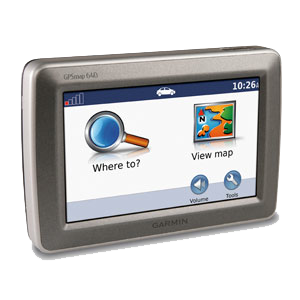
Well, there’s a new kid in town. The Garmin GPSMAP 640 looks like it’s going to be the new favorite of overlanders. It addresses both of my issues with the 478. It takes SD cards, and the display is a 13.2 cm (diagonal) with a resolution of 800x480 WVGA (the 478 is 9.4cm on the diagonal and has a resolution of 480x320). It’ll calculate faster than the GPSMAP 478, with SD cards it can support more memory, but it is a bit bulkier (15.0 x 10.2 x 4.8 cm vs the 478 at 14.5 x 8.1 x 4.8 cm).
There is also a GPSMAP 620, which is physically the same as the 640, but doesn’t support the XM Radio and XM Weather (which I use frequently, very handy having radar overlays when you’re in the mountains in the summer), and doesn’t come with any maps preloaded. It also costs $200 less at MSRP.
For XM Radio and XM Weather, you’ll need an XM antenna. It seems the old GXM30 won’t work with the 640, and you’ll have to transfer your existing XM subscription to the new antenna.
The GPSMAP 640 isn’t available until Q1 2009, with an MRSP of $1199 (but already available for pre-order from around $950).
As soon as Ram Mounts have their brackets ready, I’ll get one ordered.
UPDATE: So, the big issue with the GPSMAP 640 is the same as a lot of other consumer products and other GPS devices in the Garmin range - they’ve been completely dumbed down. While it’s in automotive mode, it’s impossible to access the experienced user settings, like decent weather and chart-plotting. I even logged a feature request with Garmin, who said they’d had a lot of comments regarding this but even after a couple of years haven’t implemented it. So, I cannot recommend this device as a suitable GPS for an overland vehicle. Stick with the 478 and similar.